Make Sure the Address is Geocoded
In order to show any job on the map - the job must have at least one geocoded step address.
What are geocoded addresses?
Geocoding (sometimes called forward geocoding) uses a description of a location, most typically a postal address or place name, to find geographic coordinates from spatial reference data such as building polygons, land parcels, street addresses, postal codes (e.g.ZIP codes, CEDEX), and so on.
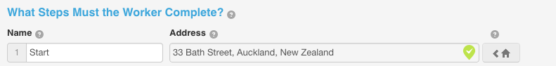
Geocoded steps are steps where the address was selected from one of the suggested options; these are shown with a green tick next to them.
Why should I use geocoding in my addresses?
Geocoding your addresses ensures the job will appear on the map and will link with GPS for easy mapping and directions.
In order to show any job on the map - the job must have at least one geocoded step address. Geocoded steps are steps where the address was selected from one of the suggested options, these are shown with a green tick next to them.
View One
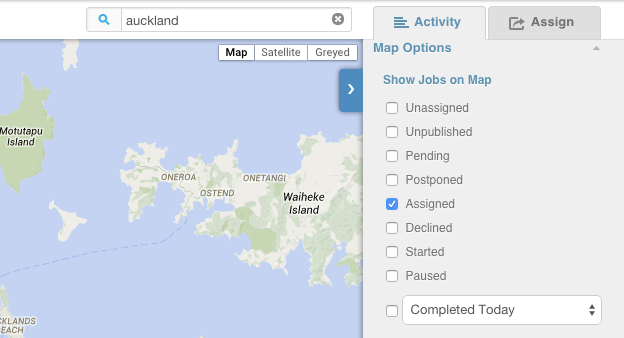
To find a specific assigned job on the map - simply click the worker it's assigned to or do a search for the job in the search box.
View All
If you wish to see all assign jobs at once, ensure the "Assigned" box is ticked to the right of the map.